Menu

miércoles, 19 de agosto de 2020

Alquezar - Pasarelas del Vero - Asque, Sierra de Guara, Spain

Alquezar - Vero footbridges - Asque, Sierra de Guara, Spain

A las 7 de la mañana, recogí a Natalie y Orlaith, y pusimos rumbo hacia Alquézar, un pequeño pueblo medieval localizado en la Comarca del Somontano, en el Parque Natural de la Sierra de de Guara.

At 7 am I picked up Natalie and Orlaith, so we were heading to Alquezar, a small medieval village located in the región of El Somontano, in Sierra de Guara National Park.

Al llegar a Alquezar, decidimos hacer la ruta que va desde Alquezar hasta Asque, pasando por las pasarelas del río Vero.

Once in Alquezar, we decided to walk the route that goes from Alquezar to Asque, going through the river Vero footbridges.

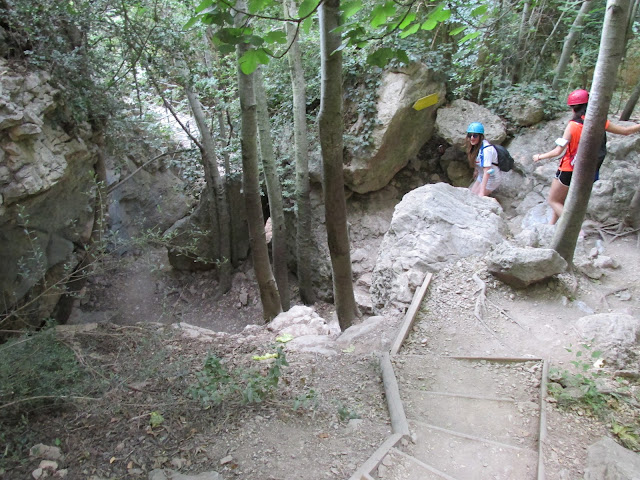
Iniciamos el camino descendiendo por el barranco de la Fuente hasta llegar al lecho del río. Para ello se han instalado numerosos puentes y escaleras de madera para facilitar el descenso.

We began the route descending to the sidebed of the river Vero through the Barranco de la Fuente (Canyon of the fountain). There are settled numeorus wooden bridges and wooden stairs to make easier the descend.


Al llegar al río Vero, giramos a la izquierda, para ver la cueva de Picamartillos.

When we got to the river sidebed, we went to the left, towards the Picamartillos Cave.


Tras visitar la cueva, nos dirigimos hacia las pasarelas. Las pasarelas se encuentran clavadas en la roca, permitiéndonos sortear el cauce del río.

After visiting the cave, we headed to the footbridges. The footbridges are nailed to the canyon walls, allowing us to miss river.

Tras pasar la primera pasarela llegamos al Azud, donde hay una pequeña cascada, y donde ¡¡POR SUPUESTO!! Natalie y Orlaith se dieron un baño.

After passing the first walkway, we got to a small dam, where there is a small waterfall and OF COURSE!! Natalie and Orlaith could not miss the chance of going for a swim.


El recorrido de las pasarelas termina en el mirador, donde hay una magnífica vista panorámica de toda el área que lo rodea.

The vero walkways route ends at the Vero viewpoint, where there a magnificent panoramic view of all the area around it. 


Desde el mirador salen dos caminos, uno ascendente de retorno a Alquezar y el que tomamos nosotros que se dirige a Asque, un pequeño poblado situado a 4 km de Alquezar.

Two paths leave the point view. An ascending one that goes back to Alquezar and the one we took that goes to Asque, a very small village located 4 km away from Alquezar.

El camino de Asque va sobre la colina situada enfrente de Alquezar, por lo que permite una gran vista del pueblo y el valle.

The Asque road goes over the hill located in from of Alquezar, so it allows a great view of the village and the valley.


En Asque tomamos algo en la posada y volvimos a Alquezar.

In Asque we had a drink in its inn, afterwards we headed back to Alquezar.


martes, 4 de agosto de 2020

Ascensión a La Raca y Lagos de Astún, Astún, España

Ascent to Mt La Raca and Astun lakes

Esta vez nuestro objetivo era hacer la subida a La Raca y lagos de Astún.
This time, our goal was riding to the summit of the mount La Raca and the tarns of Astún.


Karim y un servidor tomamos la carretera que sube de Canfranc Estación hasta el puerto de Somport, para hacerlo un poco más largo, decidimos ir por Candanchú. Al llegar a la cima del puerto, tomamos el devío hasta la cima de la estación de esquí Astún.
Karim and me took the road that goes up from Canfranc Estacion to the top of the Somport pass, to make it a bit longer, we decided to go through Candanchu. Once on top of the pass, we took the junction to Astun skiing resort.


En el aparcamiento de Astún tomamos la pista que sube hacia las colinas, siguiendola hasta que llegamos a la cima del pico La Raca (2278 m).
At Astun car park, we took the only trail that goes on the hills, following it up until we reach the top of Mt La Raca (2278 m).


Desde la cima comienzo un rápido descenso y nada más pasar el tobogán de saltos de esquí, llegamos a un cruce de pistas, tomando la que gira a la derecha, para ir primero al Ibón de Escalar (2078 m) y luego al ibón de Truchas (2144 m).
From the summit we started a fast descent, and just after passing the ski jumping slope we got to a junction where we turned right to head to the lakes, we went first to Escalar tarn (2078 m), afterwards we ride back to Truchas tarn (2144 m).


sábado, 1 de agosto de 2020

Ascensión al Lopez Huizi, Valle de Aisa, España

Ascent to Lopez Huizi Refuge, Aisa Valley, Spain

En torno a las 8:30 salí junto a Karim desde Canfranc Estación con destino Aratorés, para realizar el ascenso con bicicleta al refugio Lopez Huici, un refugio militar localizado a 2000 metros de altura.
At about 8:30 am Karim and me left Canfranc Estacion, heading for Aratores, to ascent by bike to Lopez Huici refuge, a military shelter located at an altitude of 2000 meters.


Para ir desde Canfranc Estación a Villanúa, tomamos el Camino de Santiago, ya que Karim nunca lo había hecho.
We took the “Camino de Santiago” (Pilgrim’s Path), to go from Canfranc Estacion to Villanua, as Karim have never done it before.


Al llegar a Aratorés, rellenamos los botellines, ya que no hay posibilidad de obtener agua durante el ascenso. Tras repostar subimos el resto del puerto hasta la rotonda donde comienza la pista forestal de Las Blancas. En el inicio de la pista hay un letrero que el refugio está a 18 km.
When we arrived to Aratores, we filled up our bottles, as there is no chance of getting water in the ascent. After having refilled our bottles, we climbed the rest of the hill until the round about, where the trail “Las Blancas” starts. At the beggining of the Trail there is an information sign saying that the shelter is 18 km away from there.


Poco a poco ganamos más y más altura hasta que dejamos atrás el bosque y pudimos disfrutar por fin de unas mejores vistas al valle.
We got higher and higher, as soon as we left the forest behind we could enjoy the magnificent view of the valley.


Cuando alcanzamos los 2000 metros de altura, llegamos a un pequeño refugio, que debe ser para pastores. Estaba cerrado, por lo que continuamos nuestro camino.
When we reached 2000 meters above sea level, we got to a little shelter that I reckon is for shepherds. It was locked so we carried on.
Continuamos ascendiendo hasta 2200 metros y la pista por fin comenzó a descender. Descendimos hasta llegar a la valla que cerraba el paso a vehículos e indicaba que aquello era zona militar. La pasamos y continuamos hasta llegar por fin al refugio de López Huici.
We kept ascending until we reached 2200 meters and the road finally went down. We descended until we got to the gate that says that you are about to get in a restricted area, we passed the gate and finally got to Lopez Huice refuge.

El refugio está un poco descuidado y por lo cantidad de mapas y notas que hay, parece que últimamente ha sido usado por espeleólogos.
The refuge is a bit of a mess. For the amount of maps and notes, it looks like lately it has been used by speleogists. 


Tras tomar un merecido descanso, iniciamos un técnico descenso en el que hay que tener mucho cuidado ya que hay mucha piedra suelta.
After havinging a deserved break, we began the descent, which is quite technical and you must be aware all the time, as there are a lots of loose stones.