
Three Lakes Hike, Durmitor National Park, Montenegro
En nuestro último día en el país balcánico, Charlie y yo teníamos pensado subir al pico Bobotov Kuk (2523 m), el más alto del país.
In our last day in the Balkan country, Charlie and I had planned to climb Bobotov Kuk peak(2523 m), the highest peak in the country.
A las 6 de la mañana pusimos rumbo al Parque Nacional Durmitor, el área montañosa del país y donde se encuentra Bobotov Kuk. La climatología no era muy buena, pero decidimos arriesgarnos e ir para ver si había alguna posibilidad de hacer algo.
At 6am we headed to Durmitor National Park, the mountainous area of the country and where Bobotov Kuk is located. The forecast said that the weather was not very good, but we decided to take a chance and go to see if there was any possibility of doing something.
Al llegar a Durmitor paramos en Zabljak, el pueblo mas grande de la zona, donde tomamos un café y fuimos a la oficina de turismo para preguntar si la ascensión era viable. En la oficina de turismo nos dijeron que no podíamos hacer la ascensión al Bobotov Kuk debido a la niebla y a la alta posibilidad de tormenta eléctrica, pero en su lugar nos dijeron que podíamos hacer la ruta de los 3 Jezero (Ruta de los 3 lagos), por lo que al salir de la oficina de turismo nos dirigimos al lago Crno Jezero, el lago más grande y famoso del Parque Nacional, donde comienza la ruta.
When we reached Durmitor we stopped at Zabljak, the biggest town in the area, where we had a coffee and went to the info office to ask if the ascent was viable. At the info office they told us that we could not ascend to Bobotov Kuk due to the fog and the high possibility of thunderstorm, but instead they told us that we could make the route of the 3 Jezero (the 3 lakes hike) , so when we left the info office we headed to Crno Jezero lake, the largest and most famous lake in the National Park, where the route begins.

Once in Crno Jezero, we took the path that goes to the right of the lake, towards Jakšića Mlin, a little white stone house.


At Jakšića Mlin we continued for a more or less flat path until we reach Zminje Jezero, the first lake of the route.


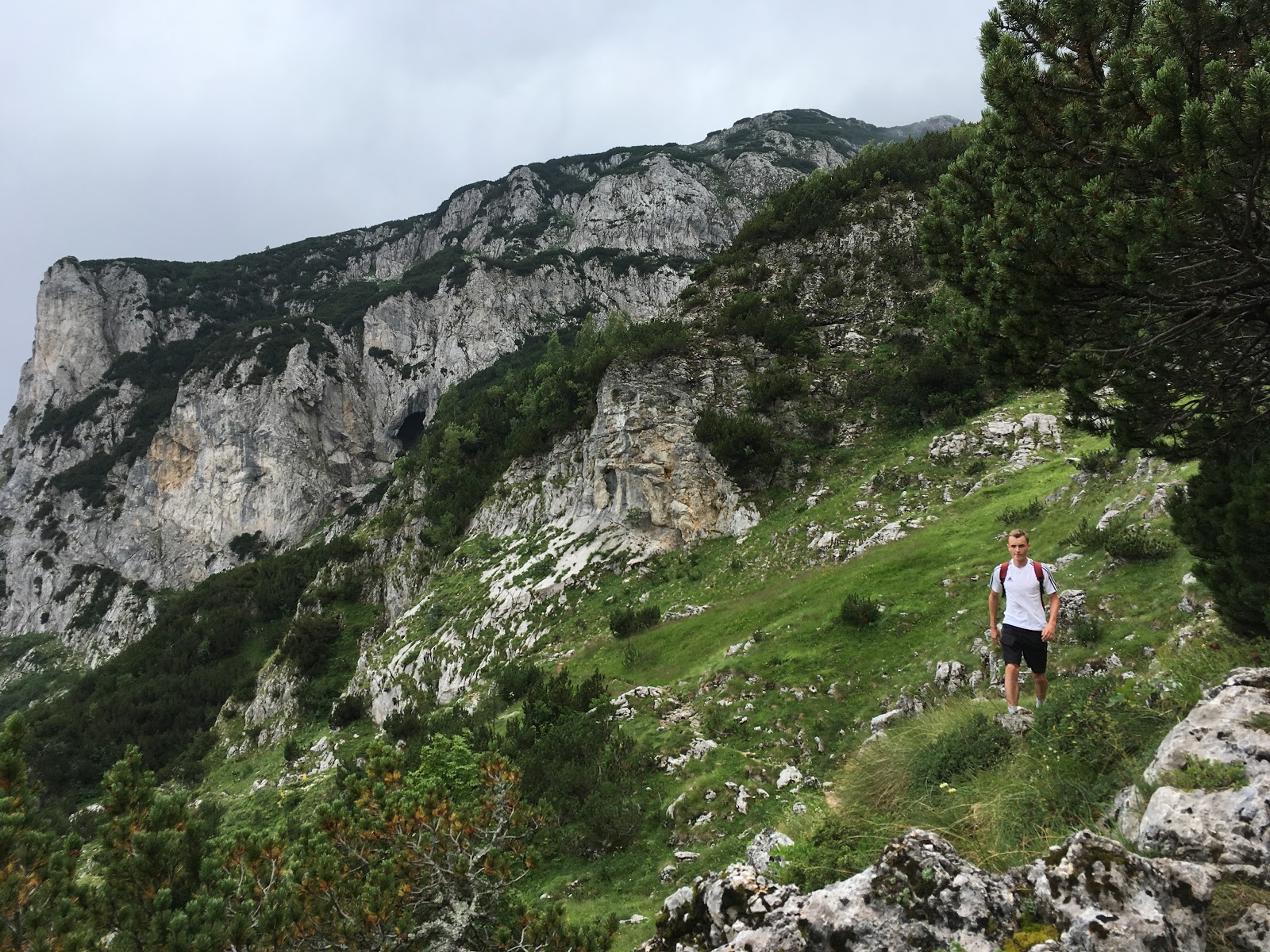
Desde Zminje Jezero en adelante la ruta se endurece, ya que comenzamienza la ascensión al pico Crvena Greda (2164 m).
From Zminje Jezero onwards the route gets harder, as the ascent to Crvena Greda peak (2164 m) begins.

La primera parte de la ascensión es bastante vertical y no presenta mucha dificultad.
The first part of the ascent is quite vertical but it is not very difficult.


La segunda parte del ascenso comienza en el desvío situado a 1940 metros, debido a que el camino se convierte en un pequeño sendero bastante más peligroso, ya que tiene tramos de mucha exposición y debido a la hierba, en condiciones húmedas pueden ser bastante resbaladizo.
The second part of the ascent starts at the crossing located at 1940 meters, because the path becomes in a much more dangerous little path, as it has some areas of high exposure and because of the grass, in wet conditions can be quite slippery.


En la cima tomamos un pequeño descanso antes de iniciar el descenso.
In the summit we took a short break before starting the descent.


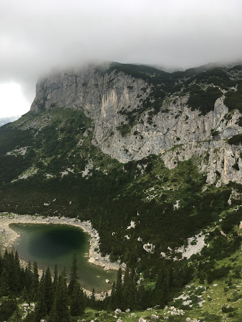
El descenso pasa junto a los lagos Jablan Jezero y Barno Jezero, y termina en Crno Jezero.
The descent passes next to Lakes Jablan Jezero and Barno Jezero, and ends in Crno Jezero.


No hay comentarios:
Publicar un comentario